


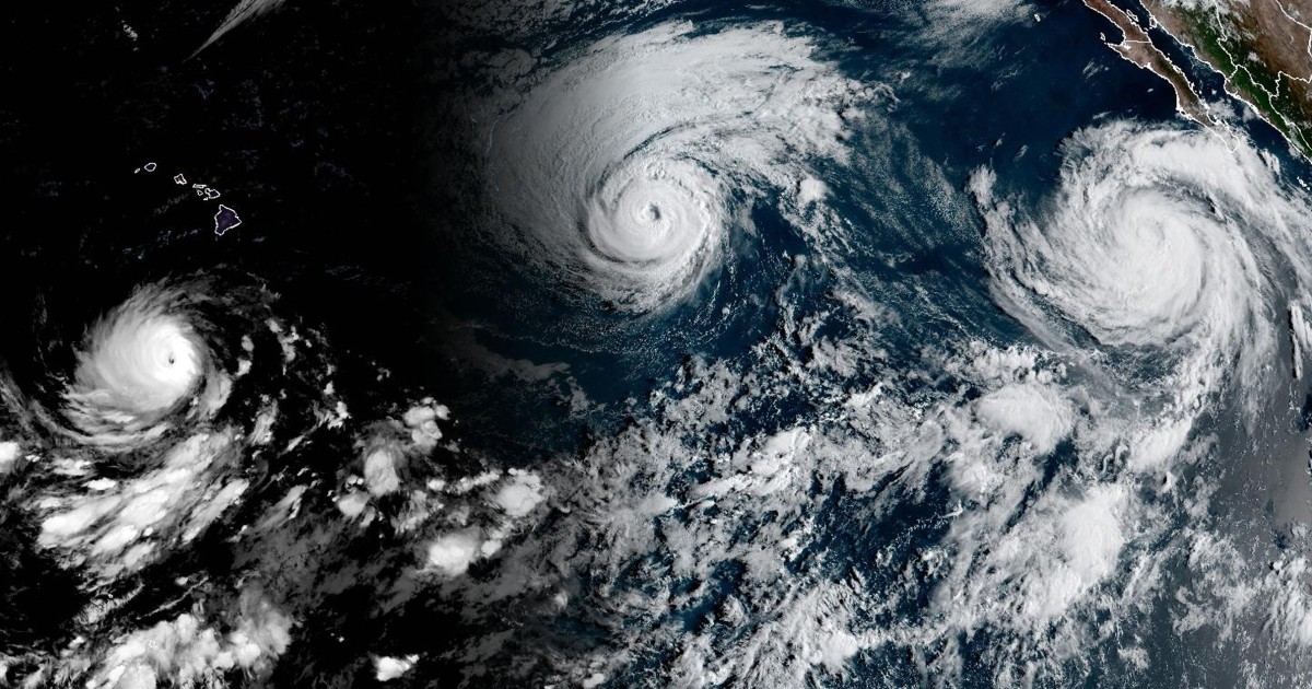
Three hurricanes — Karina, Lowell and Marie — are churning in the Pacific Ocean, a high level of activity that climate scientists say is on brand for El Niño, especially given that this year’s event is likely to become the strongest on record.Two of the storms hit major hurricane status this week.Lowell, which could target Hawaii this weekend, reached Category 5 strength Wednesday and has since weakened to Category 3.
The storm is moving west but expected to make a sharp turn to the north over the weekend, according to the National Hurricane Center, taking it near the islands of Oahu and Kauai.The forecast comes as Hawaii is still recovering from multiple instances of heavy rain and flash flooding over the last six months.
Just weeks ago, parts of Oahu and the Big Island were hit with intense flooding and strong winds from Tropical Storm Lala.Damage also remains from devastating floods in March, when more than 25 inches of rain fell in some parts of Oahu and more than 19 inches in parts of Maui.Meanwhile, Karina has weakened from Category 3 to Category 2 east of the Hawaiian islands and is forecast to weaken further over the next 48 hours, according to the hurricane center.
Marie, located nearly 400 miles off the coast of Mexico’s Baja California Peninsula, is strengthening.The storm could generate strong swells for portions of Mexico’s southwestern coast and Baja California through the weekend, and perhaps Southern California, too, according to the hurricane center.The trio of hurricanes represent a level of elevated activity consistent with El Niño, a natural climate pattern characterized by warmer-than-usual sea surface temperatures in parts of the Pacific Ocean.
This year, the National Oceanic and Atmospheric Administration and other forecasting agencies predict an exceptionally strong El Niño, or “super El Niño,” marked by water temperatures at least 2 degrees Celsius (3.6 degrees Fahrenheit) above average in the Pacific.NOAA’s forecast...